17 Best Running Routes in America

by Rachel Chang

17 Best Running Routes in America

by Rachel Chang

Add to the adrenaline rush of a good run by finding a route that adds visual stimulation as well. From serene landscapes to historic landmarks, here are some of the most unique running paths in the U.S that allow for safe social distancing—and are currently open (but check first before going).

17
Letchworth State Park (Castile, NY) / iStock / jimvallee
Granite Mountain Loop Trail (Scottsdale, AZ)
1 of 17
Granite Mountain Loop Trail (Scottsdale, AZ)

Wildflowers and saguaro cacti paint the scenery at Scottsdale’s McDowell Sonoran Preserve, with numerous trails fit for runners. Start at the Granite Mountain trailhead in the northern area for a stunning run along the Granite Mountain Loop Trail, whether you choose the 3-mile Scenic path or the 6.1 mile Long Loop. If you’re inclined for inclines, choose the steeper Brown’s Mountain Trail. 

Wildflowers and saguaro cacti paint the scenery at Scottsdale’s McDowell Sonoran Preserve, with numerous trails fit for runners. Start at the Granite Mountain trailhead in the northern area for a stunning run along the Granite Mountain Loop Trail, whether you choose the 3-mile Scenic path or the 6.1 mile Long Loop. If you’re inclined for inclines, choose the steeper Brown’s Mountain Trail. 

Almaden Lake Park (San Jose, CA)
2 of 17
Almaden Lake Park (San Jose, CA)

Despite being the 10th largest U.S. city, California’s South Bay city of San Jose is home to more than 200 parks and one of the country’s largest urban trail networks, currently covering 61 miles. One highlight is Almaden Lake Park’s Lake Almaden Trail, which loops around the 30-acre lake with a bird sanctuary in the center. The path also connects to the 3.9-mile Los Alamitos Creek Trail

Despite being the 10th largest U.S. city, California’s South Bay city of San Jose is home to more than 200 parks and one of the country’s largest urban trail networks, currently covering 61 miles. One highlight is Almaden Lake Park’s Lake Almaden Trail, which loops around the 30-acre lake with a bird sanctuary in the center. The path also connects to the 3.9-mile Los Alamitos Creek Trail

Washington & Old Dominion Trail (Loudoun County, VA)
3 of 17
Washington & Old Dominion Trail (Loudoun County, VA)

Following the Washington & Old Dominion Railroad’s old roadbed, Nova Parks’ Washington & Old Dominion Trail runs through 45 miles of northern Virginia, outside of Washington, D.C. Created in 1847 as a way to transport commerce westward from Alexandria, the path now travels through Virginia cities like Arlington, Falls Church, Vienna, and Leesburg—with endpoints in Shirlington and Purcellville.

Following the Washington & Old Dominion Railroad’s old roadbed, Nova Parks’ Washington & Old Dominion Trail runs through 45 miles of northern Virginia, outside of Washington, D.C. Created in 1847 as a way to transport commerce westward from Alexandria, the path now travels through Virginia cities like Arlington, Falls Church, Vienna, and Leesburg—with endpoints in Shirlington and Purcellville.

Rattlesnake Canyon Trail (Grand Junction, CO)
4 of 17
Rattlesnake Canyon Trail (Grand Junction, CO)

For those looking to run to new heights, the 15.5-mile Rattlesnake Canyon Trail has an elevation gain of 2,444 feet. But that extra effort will be worth the sweat, as you’ll be treated to the second-largest concentration of natural arches after Utah’s Arches National Park. Along the way, take in sights of spires, canyons, and wildflowers on the out-and-back route.

For those looking to run to new heights, the 15.5-mile Rattlesnake Canyon Trail has an elevation gain of 2,444 feet. But that extra effort will be worth the sweat, as you’ll be treated to the second-largest concentration of natural arches after Utah’s Arches National Park. Along the way, take in sights of spires, canyons, and wildflowers on the out-and-back route.

Lost Lake Trail (Seward, AK)
5 of 17
Lost Lake Trail (Seward, AK)

As part of Iditarod National Historic Trail, the Lost Lake Trail near Seward, Alaska, starts at Mile 5 of Seward Highway. “I love this trail because it gains more than 1,000 feet in the first 5 miles, but the grind immediately pays off as you get 4 miles of rolling terrain through a beautiful valley with alpine lakes and wildflowers before the descent,” Brooks Running athlete Allie Ostrander says.

As part of Iditarod National Historic Trail, the Lost Lake Trail near Seward, Alaska, starts at Mile 5 of Seward Highway. “I love this trail because it gains more than 1,000 feet in the first 5 miles, but the grind immediately pays off as you get 4 miles of rolling terrain through a beautiful valley with alpine lakes and wildflowers before the descent,” Brooks Running athlete Allie Ostrander says.

Bothe Napa Valley (Napa Valley, CA)
6 of 17
Bothe Napa Valley (Napa Valley, CA)

Bothe Napa Valley State Park offers ten miles of hiking in northern California along its seven trails. The most popular for runners is the Vineyard Trail, which loops off of the 8-mile Ritchey Canyon Trail and goes around a scenic neighborhood vineyard. Also within the park is the Coyote Peak Trail with forest and canyon views and Native American Garden Trail with ceremonial and medicinal plants. 

Bothe Napa Valley State Park offers ten miles of hiking in northern California along its seven trails. The most popular for runners is the Vineyard Trail, which loops off of the 8-mile Ritchey Canyon Trail and goes around a scenic neighborhood vineyard. Also within the park is the Coyote Peak Trail with forest and canyon views and Native American Garden Trail with ceremonial and medicinal plants. 

Grand Rounds Scenic Byway System (Minneapolis, MN)
7 of 17
Grand Rounds Scenic Byway System (Minneapolis, MN)

For more than a century, Minneapolis’ Grand Rounds Scenic Byway System has been one of the nation’s longest continuous public urban parkways. The 51 miles of running paths loops around the entire city, including a 1.2-mile section on the downtown riverfront, 9.2-mile stretch on the Mississippi River, and 13.3 miles along the Chain of Lakes connecting five of the city’s southwestern lakes.

For more than a century, Minneapolis’ Grand Rounds Scenic Byway System has been one of the nation’s longest continuous public urban parkways. The 51 miles of running paths loops around the entire city, including a 1.2-mile section on the downtown riverfront, 9.2-mile stretch on the Mississippi River, and 13.3 miles along the Chain of Lakes connecting five of the city’s southwestern lakes.

Trinity Trails (Fort Worth, TX)
8 of 17
Trinity Trails (Fort Worth, TX)

The Trinity Trails of Fort Worth cover 21 parks, 31 neighborhoods, and more than 100 miles of trails. Whether you prefer urban views of the Fort Worth skyline and Panther Island Pavilion, the natural landscape of the Trinity River, and the woods or public art in the mural gallery, the paths offer a variety of settings with multiple entry points. 

The Trinity Trails of Fort Worth cover 21 parks, 31 neighborhoods, and more than 100 miles of trails. Whether you prefer urban views of the Fort Worth skyline and Panther Island Pavilion, the natural landscape of the Trinity River, and the woods or public art in the mural gallery, the paths offer a variety of settings with multiple entry points. 

The Loop (Tucson, AZ)
9 of 17
The Loop (Tucson, AZ)

For runners who prefer hard surfaces, the Chuck Huckelberry Loop, known as just The Loop, offers 131 miles of paved pathways in Pima County. The final section connecting Rillito and Pantano River Parks was finished in 2018, turning the path into a true “loop.” Along the way, take in artwork like concrete frogs, mosaic murals, and even a steel sculpture of a bat on a mountain bike!

For runners who prefer hard surfaces, the Chuck Huckelberry Loop, known as just The Loop, offers 131 miles of paved pathways in Pima County. The final section connecting Rillito and Pantano River Parks was finished in 2018, turning the path into a true “loop.” Along the way, take in artwork like concrete frogs, mosaic murals, and even a steel sculpture of a bat on a mountain bike!

Swamp Rabbit Trail (Greenville, SC)
10 of 17
Swamp Rabbit Trail (Greenville, SC)

Soak in every kind of vibe—including the urban (the city of Greenville), historic (former textile factories), collegiate (Furman University) and rural (Reedy River waterfalls)—along the 22-mile mixed-use Prisma Health System Swamp Rabbit Trail, in South Carolina’s Blue Ridge Mountains from Greenville to Travelers Rest. (Portions within city limits may be blocked off because of COVID-19 concerns). 

Soak in every kind of vibe—including the urban (the city of Greenville), historic (former textile factories), collegiate (Furman University) and rural (Reedy River waterfalls)—along the 22-mile mixed-use Prisma Health System Swamp Rabbit Trail, in South Carolina’s Blue Ridge Mountains from Greenville to Travelers Rest. (Portions within city limits may be blocked off because of COVID-19 concerns). 

 Mission Reach (San Antonio, TX)
11 of 17
Mission Reach (San Antonio, TX)

Literally run through history on the eight-mile Mission Reach along San Antonio River Walk that leads you to four UNESCO World Heritage Site 18th century Spanish colonial missions, including Mission San Jose, dubbed the “Queen of the Missions.” Also pass through Confluence Park, which just opened in 2018, and keep your eyes peeled for the 186 different species of birds flying through the area. 

Literally run through history on the eight-mile Mission Reach along San Antonio River Walk that leads you to four UNESCO World Heritage Site 18th century Spanish colonial missions, including Mission San Jose, dubbed the “Queen of the Missions.” Also pass through Confluence Park, which just opened in 2018, and keep your eyes peeled for the 186 different species of birds flying through the area. 

Halpatiokee Regional Park (Stuart, FL)
12 of 17
Halpatiokee Regional Park (Stuart, FL)

On South Florida’s Treasure Coast between Orlando and Miami is Martin County, which boasts 100,000 acres of parks and conservation lands, including Halpatiokee Regional Park with 65 active acres within its 500 wetland preserve acres. While the trails traverse pine Flatwoods, oak hammock and river lands, runners especially flock to the four miles of waterfront trails along the St. Lucie River.

On South Florida’s Treasure Coast between Orlando and Miami is Martin County, which boasts 100,000 acres of parks and conservation lands, including Halpatiokee Regional Park with 65 active acres within its 500 wetland preserve acres. While the trails traverse pine Flatwoods, oak hammock and river lands, runners especially flock to the four miles of waterfront trails along the St. Lucie River.

Lake Stanley Draper (Oklahoma City, OK)
13 of 17
Lake Stanley Draper (Oklahoma City, OK)

Social distancing at its best. The 12-foot-wide pathways of one of Oklahoma City’s newest paved trails at Lake Stanley Draper allow plenty of space for a carefree comfortable run. Located about 17 miles southeast of downtown, the paths include 34 shoreline miles around the 2,900-acre lake, as well as a 13.5-mile stretch with public art pieces.  

Social distancing at its best. The 12-foot-wide pathways of one of Oklahoma City’s newest paved trails at Lake Stanley Draper allow plenty of space for a carefree comfortable run. Located about 17 miles southeast of downtown, the paths include 34 shoreline miles around the 2,900-acre lake, as well as a 13.5-mile stretch with public art pieces.  

Lexington (Lexington, KY)
14 of 17
Lexington (Lexington, KY)

This 6.8-mile run doubles as a sightseeing tour starting at the Henry Clay Estate and then over to Woodland Park for a loop around its paths. Next head to the pedestrian paths of the University of Kentucky campus before running through the South Hill historic neighborhood and through downtown Lexington before the grand finale on Winchester Road’s residential neighborhood.

This 6.8-mile run doubles as a sightseeing tour starting at the Henry Clay Estate and then over to Woodland Park for a loop around its paths. Next head to the pedestrian paths of the University of Kentucky campus before running through the South Hill historic neighborhood and through downtown Lexington before the grand finale on Winchester Road’s residential neighborhood.

Duke University (Raleigh-Durham, NC)
15 of 17
Duke University (Durham, NC)

While the North Carolina university was founded in 1838, the campus was built in 1932, mixing Gothic and Georgian styles and offering an inspiring setting for a run. Explore the main campus’ east side, including the 210-foot-tall Duke Chapel or follow the 3.7-mile Al Buehler Trail around a golf course. For a pop of color, head to Sarah P. Duke Gardens (currently closed) for a run among the blooms.

While the North Carolina university was founded in 1838, the campus was built in 1932, mixing Gothic and Georgian styles and offering an inspiring setting for a run. Explore the main campus’ east side, including the 210-foot-tall Duke Chapel or follow the 3.7-mile Al Buehler Trail around a golf course. For a pop of color, head to Sarah P. Duke Gardens (currently closed) for a run among the blooms.

 Letchworth State Park (Castile, NY)
16 of 17
Letchworth State Park (Castile, NY)

Nicknamed Grand Canyon of the East, Letchworth State Park in Central New York’s Finger Lakes is headlined by the Genesee River’s three roaring waterfalls. With 66 miles of marked trails, it’s a runner’s paradise. One popular route is the 14-mile Gorge Trail, which starts in Upper Falls and follows the river, passing by Glen Iris Inn, where Caroline’s Restaurant provides the perfect pit stop. 

Nicknamed Grand Canyon of the East, Letchworth State Park in Central New York’s Finger Lakes is headlined by the Genesee River’s three roaring waterfalls. With 66 miles of marked trails, it’s a runner’s paradise. One popular route is the 14-mile Gorge Trail, which starts in Upper Falls and follows the river, passing by Glen Iris Inn, where Caroline’s Restaurant provides the perfect pit stop. 

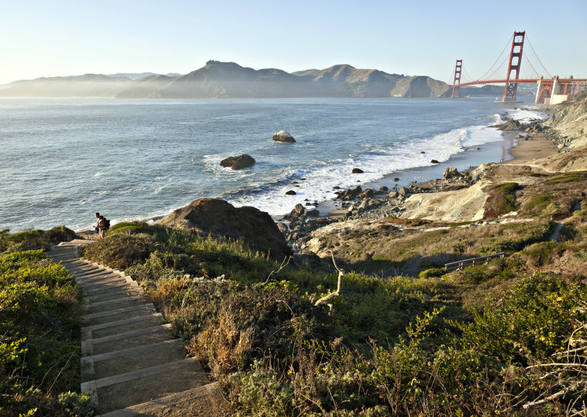
The Presidio (San Francisco, CA)
17 of 17
The Presidio (San Francisco, CA)

At the foot of the Golden Gate Bridge is the 1,491-acre urban park, the Presidio. What started as a Spanish military fort in 1776 later became a U.S. Army post in 1846 before turning into a national park in 1994. The 24 miles of hiking trails and 25 miles of biking trails are all open to runners. Zip through eucalyptus forests or pound the pavement by Crissy Field with sprawling Bay views.

At the foot of the Golden Gate Bridge is the 1,491-acre urban park, the Presidio. What started as a Spanish military fort in 1776 later became a U.S. Army post in 1846 before turning into a national park in 1994. The 24 miles of hiking trails and 25 miles of biking trails are all open to runners. Zip through eucalyptus forests or pound the pavement by Crissy Field with sprawling Bay views.

Up next...

These Incredible Budget-Friendly, Design-Forward Hotels Are Definitely Worth A Stay

Qbic London
Go Back
Find The Best Cruises
Find a cruise

Find the best deals!

Click on multiple sites to get the lowest prices

Click on multiple sites to get the lowest prices